CLICK HERE TO
BUY Thunder from a Clear
Sky
This is an 1880 map of
Henderson, Kentucky, from D. J. Lake & Co. The map
conspicuously shows a railroad running up Fourth Street
that was not present during the Civil War. Other than that,
the map is a close proximity to the town layout during the
war. The marked rectangle is the location from where Adam
Johnson and his "band-of-three" attacked the Union garrison
on the evening of June 29, 1862. The marked circle is where
the Union garrison was headquartered that evening. You can
still walk Main Street in Henderson today and get a feel
for how the attack was executed. The large blank area at
the top of the map is the river bank slope leading to the
Ohio River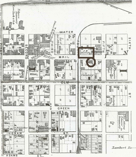 .
.
From the Illustrated Atlas of Henderson County
from D. J. Lake & Co. (Philadelphia),
1880.
